Siracusa-Noto area
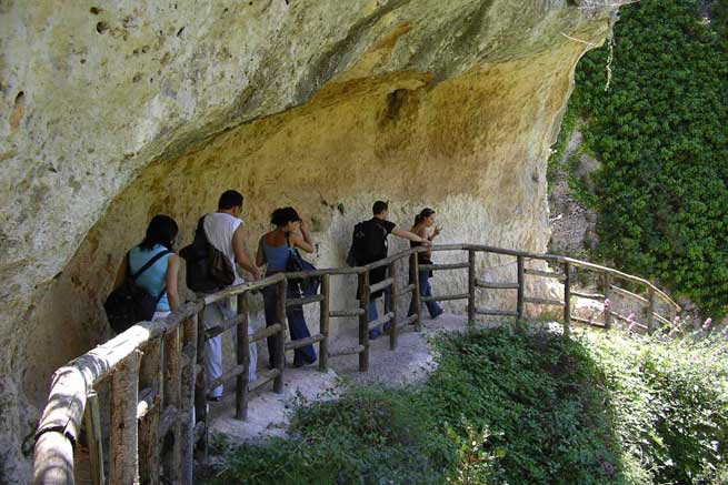
Cava d'Ispica trekking route
Start:cava d'IspicaTrekking time:300minDifficulty level:challengingArrival:cava d'IspicaAltitude start:100mAltitude arrival:100Altitude difference:0m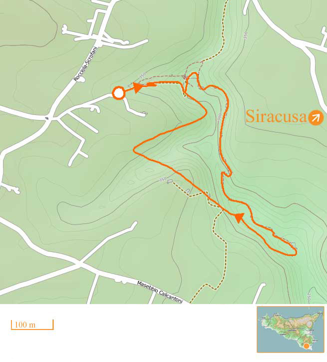
"The rocky village ring track", a breath taking track hewn out of the rock face. Amazing landscapes in one of the most striking spots within the Iblei mountain chain.
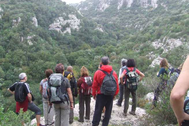
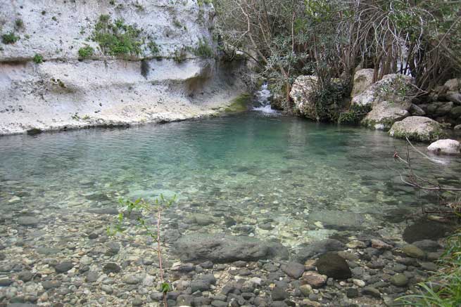
Cavagrande del cassibile trekking route
Start:belvedere, laghetti di AvolaTrekking time:180minDifficulty level:challengingArrival:belvedere, laghetti di AvolaAltitude start:100mAltitude arrival:100Altitude difference:500m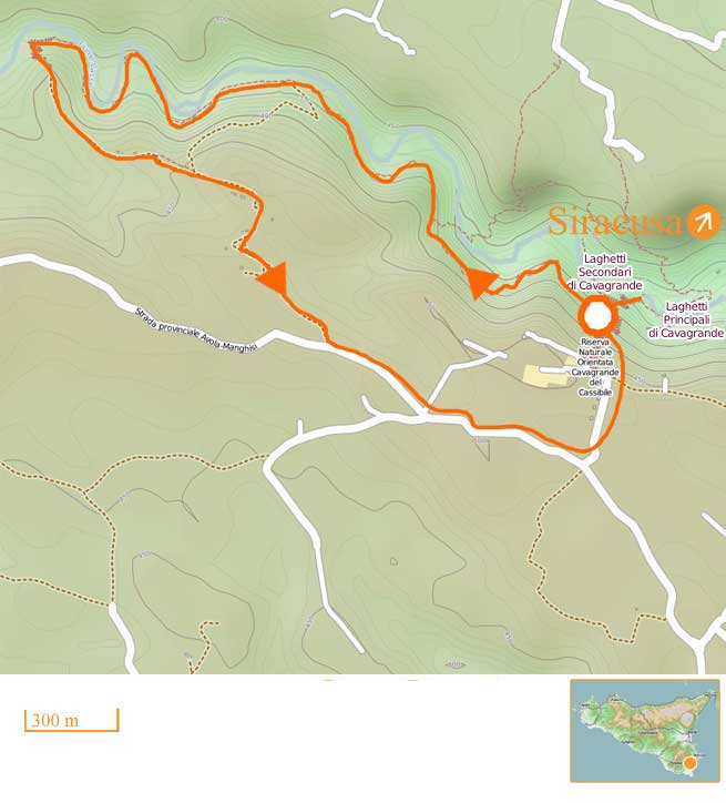
A 10 kilometers long (and 250 meters deep) canyon and nature trail along the river Cassibile. The landscape is fantastic. Naturalistic and archaeological track (byzantine village). Lakes of cristal clear water along the route.
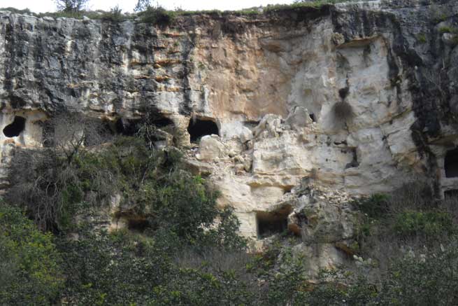
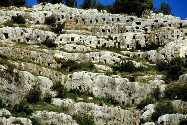
Pantalica trekking route
Start:Necropoli nordTrekking time:180minDifficulty level:easyArrival:Necropoli nordAltitude start:289mAltitude arrival:289Altitude difference:126m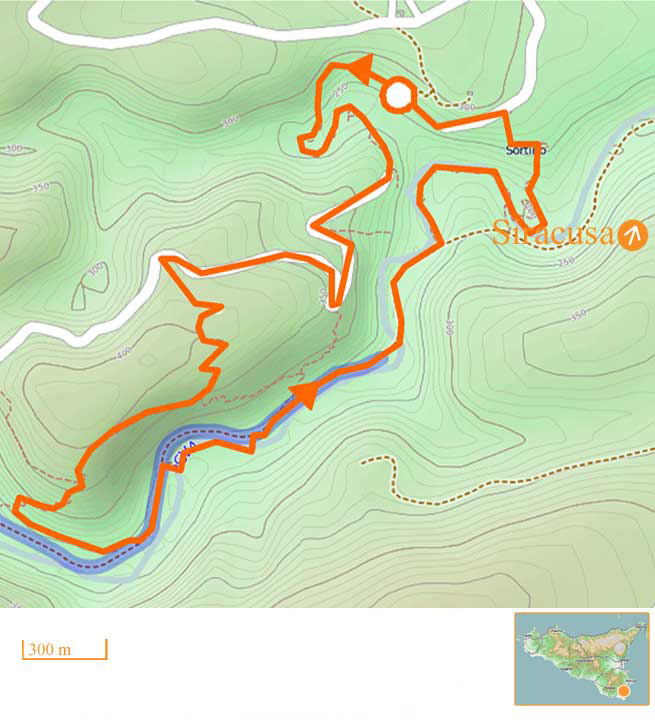
North necropolis, Calcinara streem, necropolis of Pantalica, the castle, necropolis south, river Anapo, necropolis north. Historic and naturalistic itinerary also listed by the UNESCO. Get there by car from Sortino.
Oasi di Vendicari trekking route
Start:ingresso EloroTrekking time:240minDifficulty level:easyArrival:ingresso EloroAltitude start:0mAltitude arrival:0Altitude difference:0m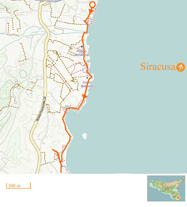
Eloro gateway, beach of Cala Mosche, the swamps, the tuna fishery (tonnara), beach the svevian tower, exit Cittadella. Seascape route with bird watching observation points inside a WWF set Nature Park. A 10 km track.


Recommended accommodations in this area

From €70/person breakfast incl.

Rooms/Apartments: from €51/person

From €65/person breakfast incl.

From €60/person breakfast incl.